10 hectares,40 households,266 farmers.
BCDA says 10 hectares and 40 households. The Department of Agriculture says 266 farmers on 410 hectares. Inside a reconstructed 1,633.1-hectare site, we mapped 547 hectares of active farmland and 114 roofs.
Pax Silica has been a very pressing issue over the last few months. A recurring issue that makes it so controversial is the refusal of the government to provide any form of transparency. Whether through documents, figures, or details, we are always provided subpar information that benefits the initiative through a lack of accountability.
The Philippines joined the Pax Silica initiative in April 2026, when about 1,619 hectares inside New Clark City were designated an Economic Security Zone.1718Looking through the past statements, it seems that even they don't know what the details are (or pretend not to). Discourse between different government agencies repeatedly gave different numbers for the same metrics, same project.
Public Statements
In July 2026, BCDA responded to multiple concerns and criticisms. Kalikasan National Coordinator Cathleen De Guzman had pressed the agencies on the project’s environmental safeguards.
“Verbal reassurances of environmental safeguards are not what is needed; what is needed is scientific data.”Cathleen De Guzman.
BCDA’s response to the critiques basically sums up to: "The land is in our name, they have no right to be on our land. Despite this, we have prepared programs for the affected people. Everything we do is ethical and environmentally compliant". Most notably, the agency said only about 10 farmers were affected while about 200 potential jobs could be created.1920
“Sa lugar na ito ay dapat wala nang farmers dahil ito ay na-approve na bilang buildable zones.”Claire Castro.
The area affecting the Aeta community is roughly 10 hectares inside the roughly 1,600-hectare site, involving about 40 households or 200 people.Joshua Bingcang.
266 farmers tilling 410 hectares would feel the adverse impact of the project.Francisco Tiu Laurel Jr.
The agencies also pointed to the absence of an ancestral-domain claim. But the Aeta Hungey application (CADT Application No. R03-TAR-002-A), has been pending since 1986, some accounts say 1999, and remains unapproved. NCIP endorsed it in 1994. The application has not met the genealogy, map, and census requirements, according to NCIP Tarlac. The requirements being to prove they have lived there since before or during the Spanish period, or to show a genealogy of at least five clans dating back at least three generations or to the precolonial period, with elder testimonies, a domain map, and a census.1516
Following their statements of "No farmers affected", the BCDA sends letters telling the residents that their land may be AFFECTED and that they must vacate by december. As expected by the thoughtful and caring nature of the government, they offer 30 whole pesos per square meter.082315
Compensation
₱30 per square metre
Tarlac figure is the median listing price for an agricultural farm, November 2026. Listing prices are asking prices, not appraisals.
| Date | What was said | Takeaways | Source |
|---|---|---|---|
| Jul 2026 | BCDA says “only around 10 farmers” are affected. | 10 farmers affected. First public count, with no map or list. | GMA / Manila Bulletin ↗ |
| Aug 2, 2026 | Sen. Imee Marcos cites reports that 92 farmers may be affected. | 92 farmers reported. Nine times the first count, still not an agency survey. | Manila Bulletin ↗ |
| Aug 3, 2026 | “Sa lugar na ito ay dapat wala nang farmers dahil ito ay na-approve na bilang buildable zones.” | 0 farmers. The land is labelled buildable, so the count becomes zero. | GMA News ↗ |
| Aug 6, 2026 | BCDA and DTI repeat that no farmers or IPs will be displaced. | 0 farmers, repeated. Agencies maintain no displacement as residents report vacate notices. | GMA / Manila Bulletin ↗ |
| Sep 2026 | An FOI request for the site boundary map and geospatial data is refused. | No map. FOI request for the site polygon and geospatial data refused. | GMA/AFP / Sanad ↗ |
| Sep 21-22, 2026 | BCDA says about 10 hectares, 40 households, or 200 people are directly affected. | 10 ha / 40 households / 200 people. A small direct-impact footprint inside a 1,619 ha site. | Radio Free Asia / GMA/AFP ↗ |
| Sep 30, 2026 | The Department of Agriculture says 266 farmers tilling 410 hectares are affected. | 266 farmers / 410 ha. The largest farmland figure, with no map or enumeration. | BusinessMirror ↗ |
| Oct 19-20, 2026 | BCDA announces a relocation budget and fewer than 50 households to be moved. | Fewer than 50 households to relocate. A plan appears after months of “no one displaced.” | GMA News / Inquirer ↗ |
| Nov 4, 2026 | The Palace repeats that farmers and IPs should not be affected. | 0 farmers, repeated. The public answer returns to zero while relocation planning continues. | GMA News ↗ |
Ten farmers become 92, then zero. Later the impact is 10 hectares, 40 households, and 200 people. Then the DA says 266 farmers and 410 hectares. Each number has a different scope, but the public is asked to treat the smallest one as the answer to all of them.
Claims
It can be argued that the following claims do not contradict each other, they very well may be measuring different things, different populations, locations, legalities. However, the fact that no official statement to reconcile this, no publicly available documents or records to verify it, and no distinction between which is the basis for the project is nothing short of misleading the public. How are we supposed to form an opinion and judge the government initiative if we are not provided the basis that justifies the government’s push for this project?
| Who said it | Land | People | What it counts |
|---|---|---|---|
| Palace | 0 ha | 0 farmers | Says no farmers should be in the buildable zone, so none can be affected. |
| BCDA | 10 ha | 40 households / 200 people | Direct impact inside the site. A later relocation note says fewer than 50 households. |
| Department of Agriculture | 410 ha | 266 farmers | Farmland and farmers reported as adversely affected. No map or enumeration published. |
The government has used about 10 hectares and about 40 households as its public answer on direct impact (the smallest number, how convenient). It has not published how they got those numbers or the records that would allow anyone to check their claims. A government that says it affects only 10 hectares should be able to publish the 10 hectares.
Government's Justification
The government’s argument basically sums up to:
The government's justification basically sums up to: “Naka pangalan samen tong lupa na toh, wala dapat mga magsasaka dito kasi nakapangalan samin toh. Kaya, walang maaapektuhang magsasaka dahil wala dapat dito.”
Despite this rationale, they send letters to the locals saying "Your land may be affected" and that they should leave by december with 30 pesos per square meter compensation. So how can they claim that no farmers will be affected when they themselves tell the residents their land will be affected? Just because there shouldn't be any farmers there doesn't mean there aren't.0823
The BCDA claims to have a relocation program in place with an estimated 25-30 million peso budget, zero cost to the residents who relocate. They also mentioned 100 hectares of land to be allocated for farming, this is however not final as it was merely a request from the locals. They claim to have reached a general understanding back in September, yet other sources say the locals are worried and scared. The Inquirer reports that ownership of the farmland would remain with BCDA, while BusinessMirror reports that the number of affected households, the budget, and eligibility rules had yet to be determined. Aeta residents told RFA they fear being forced off ancestral land, and Bulatlat reports fears that new FPIC guidelines could fast-track the project.0506100423
And through all this, the public has access to 0 records. Why would we? It's not like we should care whether the farmers are relocated to a safe place, treated fairly, have access to a good community and schools, why should we have access to details like this when the government tells us it's fine?
Investigation
BCDA refused a freedom-of-information request for the site boundary map and geospatial data. It said the information was being “withheld temporarily until the official action is finalized or published.” A second request was denied in October.0813
As a result of the abundant resources and information provided for this project, Bantay Silica reconstructed the site's boundaries using satellite imagery and analysis. The reconstruction for the Pax Silica site is 1,633.1 hectares while the overall area of the reconstructed build site is 3,391.5 hectares.09
This does not claim that the site area provided was wrong. These are merely estimates from a georeferenced sketch. However, given the close margin between the reconstruction and the public statements, we can use this as a preliminary basis for analysis on the area.
NDVI area
Vegetation at or above the selected score.
Land cover
- Crop
- Tree
- Grass
- Building
- Water
Boundaries
- Reconstructed Pax Silica Site
- Named buildable areas
- Gap between areas
Reconstructed Pax Silica Site
- Site boundary / 1,633.1 ha
- ±200 m uncertainty band
Reconstructed build site
- Pax Silica site
- Ten named boundaries
- Gap / 458.3 ha
Active farmland
Calibrated probability. The estimate is 547 ha (95% CI 446–658 ha).
Active farmland
- p ≥ 0.5 / 518.1 ha
Binary map. The design-based estimate is 547 ha.
Estimated Affected Farm Land
Using the reconstructed site boundary and satellite imagery from the Sentinel-2 satellite, a classifier was trained using satellite data samples from the site from 2024-2026 to estimate the area of active farmland. The classifier used data like satellite bands and indexes like NDVI, EVI, and others to determine vegetation activity, then took samples like how much its activity changed over the span of 2 years as a basis for classification. Since crops change yearly as opposed to trees or grass who stay stagnant in their activity throughout the year, we can use the data to determine if an area is actively farmed or not. This is then used to estimate the area.
As shown from the map, the NDVI and classifier line up with their results. The classifier estimated an area of 547 hectares of active farmland. This is a sample estimate; we can say the active farmland ranges between 446–658 hectares with a 95% confidence. This is roughly ONE THIRD of the site.
NDVI area
Vegetation at or above the selected score.
Land cover
- Crop
- Tree
- Grass
- Building
- Water
Boundaries
- Reconstructed Pax Silica Site
- Named buildable areas
- Gap between areas
Reconstructed Pax Silica Site
- Site boundary / 1,633.1 ha
- ±200 m uncertainty band
Reconstructed build site
- Pax Silica site
- Ten named boundaries
- Gap / 458.3 ha
Active farmland
Calibrated probability. The estimate is 547 ha (95% CI 446–658 ha).
Active farmland
- p ≥ 0.5 / 518.1 ha
Binary map. The design-based estimate is 547 ha.
Estimated houses inside the site was also derived from the satellite imagery. A total of 114 roofs were manually counted within the project site. However, roofs do not necessarily mean number of houses, some of these could be sheds or storage places. Regardless, a majority of these were legitimate houses that show multiple residents and communities living within the area.
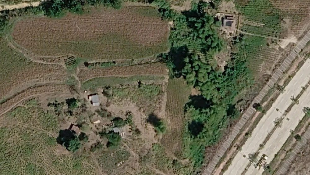
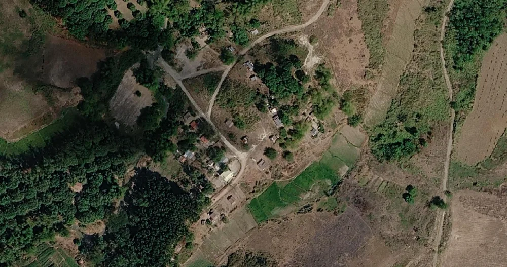
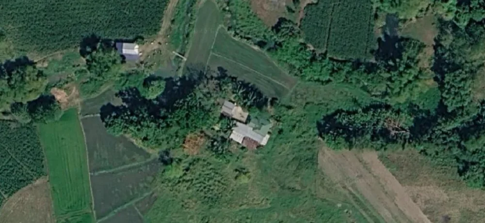
The results are not claiming that the public statements' numbers are wrong as they have not specified the details of what their numbers pertain to in the first place. The findings do however show a substantial area of farmland being used within the site, larger than any number released publicly so far, as well as multiple communities and residents. This begs the question, where did the BCDA get the 10 hectare measurement? No farmers affected? Or do they have a different definition of affected.
They won't release any substantial information on what drives the project forward. Are we to believe that the only justification for building Pax Silica is that it's an approved building zone? That the ancestral claim that has been pending for 40 years is not yet approved? That they are blatantly ignoring the lives that exist within their "buildable zone"? If not, then what?
Throughout this publication, the Pax Silica project has not only contradicted the findings presented, but also the claims of their fellow government agencies. And yet the project continues moving forward as if everything is planned out and finalized, despite the recurring statement of "Wala pang final", "Pending", or the fact that you can't even get your numbers right.
Note: The findings are inherently crude because no official boundary, enumeration, or impact polygon has been published.
Sources
- GMA News, “Palace says Pax Silica project won’t affect Tarlac farmers,” 3 August 2026.gmanetwork.com ↗
- GMA News, “Palace assures farmers, IPs won’t be neglected in Pax Silica project,” 4 November 2026.gmanetwork.com ↗
- BusinessMirror, “DA: Pax Silica will affect 266 farmers in Tarlac,” 30 September 2026.businessmirror.com.ph ↗
- Radio Free Asia, “Residents say Philippines’ Pax Silica Hub will force them off their ancestral land,” 22 September 2026.rfa.org ↗
- Inquirer/Business, “Relocation of settlers at US-backed Pax Silica site to begin in 2027,” 20 October 2026.business.inquirer.net ↗
- GMA News, “BCDA estimates P30M cost to relocate New Clark City settlers for Pax Silica,” 19 October 2026.gmanetwork.com ↗
- Manila Bulletin, “Imee Marcos seeks probe into issues surrounding Pax Silica industrial hub,” 2 August 2026.mb.com.ph ↗
- GMA/AFP, “Aeta community in Capas, Tarlac in limbo over Pax Silica hub,” 20–22 September 2026.gmanetwork.com ↗
- Bantay Silica, boundary reconstruction and method note. Current trace: pax-silica-site.geojson, 25 vertices, 1,633.1 ha geodesic, 22.7 km perimeter, ±200 m buffers 1,203.3–2,096.2 ha.this entry ↗
- BusinessMirror, “BCDA eyes 100 hectares for New Clark farmers,” 19 October 2026.businessmirror.com.ph ↗
- Daily Tribune, “Aboitiz sees wider gains from Pax Silica,” 17 August 2026.tribune.net.ph ↗
- Abante, “Rep. Alvarez inalok ang Palawan sa Pax Silica project,” 18 September 2026.abante.com.ph ↗
- Sanad, “Philippines AI hub: map request denied as Aeta families fear displacement,” 28 October 2026.sanadreport.com ↗
- Daily Tribune, “NCIP counts Aeta households amid Pax Silica concerns,” 21 August 2026.tribune.net.ph ↗
- Al Jazeera, “A Filipino tribe fights to stay as a ‘Smart City’ rises on a former US base,” 30 December 2025.aljazeera.com ↗
- Inquirer, “New Clark City: Development for whom?,” 9 July 2019.newsinfo.inquirer.net ↗
- BusinessWorld, “BCDA welcomes opportunity to address Pax Silica concerns,” 6 August 2026.bworldonline.com ↗
- CIDS, University of the Philippines, “An Analytical Framework for Assessing Philippine Participation in Pax Silica,” October 2026.cids.up.edu.ph ↗
- GMA News, “EXPLAINER: What is Pax Silica and why are people worried?,” 22 July 2026.gmanetwork.com ↗
- Manila Bulletin, “BCDA denies forcing out farmers for US-backed Pax Silica,” 6 August 2026.mb.com.ph ↗
- ABS-CBN, “Palace: No farmers will be displaced by Pax Silica Hub,” 3 August 2026.abs-cbn.com ↗
- Daily Tribune, “Tarlac tech hub location a buildable site, not farmlands, Palace,” 3 August 2026.tribune.net.ph ↗
- Bulatlat, “Will the new FPIC guidelines fast-track the Pax Silica hub in ancestral lands?,” 14 November 2026.bulatlat.com ↗
- Daily Tribune, “NCIP hears Aeta concerns over Pax Silica project,” 9 August 2026.tribune.net.ph ↗
- GMA News, “Fearing for ancestral land, Aetas from Capas urge Pax Silica cancellation,” 6 August 2026.gmanetwork.com ↗
- OnePropertee, “Lot for Sale Tarlac,” accessed 18 November 2026. Listing median for an agricultural farm in Tarlac: ₱350/sqm, with a typical range of ₱100 to ₱1,768/sqm.onepropertee.com ↗
- USDA National Agricultural Statistics Service, “Land Values 2026 Summary,” July 2026. US average farm real estate value: $4,500 per acre.nass.usda.gov ↗
Version history
| v1.0 · 17 Nov 2026 | First Release |